![]() Phantom 4 RTK (SDK)
Phantom 4 RTK (SDK)
Quick Start Guide

Phantom 4 RTK
The Phantom 4 RTK is a smart mapping and imaging drone capable of highly accurate mapping functions. The aircraft has a built-in DJITM Onboard D-RTK*, which provides precision data for centimeter-level positioning accuracy. Multi-directional obstacle sensing is enabled by forward, rear, and downward vision and infrared sensors*. The camera features a 1-inch 20-megapixel CMOS sensor housed within a high stability gimbal. When it comes to mapping, the high-performance mechanical shutter eliminates rolling shutter distortion when capturing images at speed. Image data can be used to generate maps for field planning when operating a DJI AGRASTM aircraft. Users can also import photos to the DJI TERRATM application third-party mapping software to composite highly accurate maps for different applications.
The Phantom 4 RTK uses 9455S low-noise propellers to reduce noise and improve efficiency.

| 1. Gimbal and Camera 2. Downward Vision System 3. Micro USB Port 4. Camera/Linking Status Indicator and Link Button 5. Camera microSD Card Slot 6. Forward Vision System 7. Infrared Sensing System 8. Front LEDs |
1. Gimbal and Camera 2. Downward Vision System 3. Micro USB Port 4. Camera/Linking Status Indicator and Link Button 5. Camera microSD Card Slot 6. Forward Vision System 7. Infrared Sensing System 8. Front LEDs |

 DO NOT use a mix of 9455S and 9450S propellers.
* This should be used with Network RTK service, a DJI D-RTK 2 High Precision GNSS Mobile Station (purchased additionally) or post-processed kinematic (PPK) data (recommended when RTK signal is weak during operation). The Vision and Infrared Sensing Systems are affected by surrounding conditions. Read the User Manual to learn more.
Remote Controller
The remote controller features DJI’s long-range transmission technology OcuSync which is capable of controlling the aircraft and the gimbal camera at a maximum transmission range of 4.3 mi (7 km)*. A mobile device can be connected to the remote controller via the USB port to use the DJI Pilot app (for Android), GS Pro (for iOS), or a third-party app developed using the DJI Mobile SDK*. The maximum remote controller battery life is approximately 6 hours*.

| 1. Power Button 2. Return to Home (RTH) Button 3. Control Sticks 4. Status LED 5. Battery Level LEDs 6. Power Port 7. Mobile Device Holder 8. Small Device Positioning Tabs (for mobile phones) 9. Antennas |
1. Power Button 2. Return to Home (RTH) Button 3. Control Sticks 4. Status LED 5. Battery Level LEDs 6. Power Port 7. Mobile Device Holder 8. Small Device Positioning Tabs (for mobile phones) 9. Antennas |
The figure below shows the function that each control stick movement performs, using Mode 2 as an example. The left stick controls the aircraft’s altitude and heading, while the right stick controls its forward, backward, left, and right movements. The gimbal dial controls the camera’s tilt.

* The remote controller is able to reach its maximum transmission distance (FCC) in a wide-open area with no Electro- Magnetic Interference, and at an altitude of about 400 feet (120 meters). Visit the DJI Developer website for more information about the DJI Mobile SDK. https://developer.dji.com/mobile-sdk The maximum runtime is tested under a laboratory environment, only for your reference. Pictures will only be taken when the shutter button is fully pressed.
- Download DJI Mobile Apps or DJI Assistant 2
When using your Phantom 4 RTK for the first time, activate it using the DJI Pilot app, DJI GS Pro or DJI ASSISTANT 2. Ensure that your mobile device or computer has access to the Internet.
Scan the QR code to download the app on your mobile device.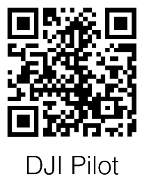
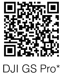
http://m.dji.net/djipilot_enterprise https://itunes.apple.com/app/dji-gs-pro/id1183717144?mt=8 If using a third-party app, download DJI Assistant 2 from the official DJI website on your computer, and then connect the aircraft to the computer to activate. https://www.dji.com/phantom-4-rtk/info#downloads
* Visit the official DJI website for more information about DJI GS Pro. https://www.dji.com/ground-station-pro - Check Battery Levels
 Press once to check the battery level. Press once, then again and hold to turn on/off.
 - Charge the Batteries
 ● Fully charge the batteries before first-time use.
 - Prepare the Remote Controller
 Optimal Transmission Zone
Try to keep the aircraft inside the optimal transmission zone. If the signal is weak, adjust the antennas or fly the aircraft closer. - Prepare for Takeof

Black propeller rings go on motors with black dots. Silver propeller rings go on motors without black dots. Press the propeller down onto the mounting plate and rotate in the lock direction  until secure

Remove the gimbal clamp from the camera. Power on the remote controller and the aircraft. Launch the app. - Flight
For a safe take-off, make sure that the Aircraft Status Indicators blink green slowly (using RTK* or GNSS for positioning).
 |
|
| Combination Stick Command to start/stop the motors | Combination Stick Command to start/stop the motors |
- Spinning propellers can be dangerous. Stay away from spinning propellers and motors. DO NOT start the motors in confined spaces or when there are people nearby.
- Always keep your hands on the remote controller when the motors are spinning.
- Stopping motors mid-flight: Perform the CSC to stop the motors. It can be enabled in a DJI app or through DJI Mobile SDK (support coming soon, requires a selection in the third-party app). Only stop motors mid-flight in emergency situations when doing so can reduce the risk of damage or injury.
* RTK positioning is recommended. If using the DJI Pilot app, go to Camera View >●●● > RTK to enable Aircraft RTK and select a method for receiving RTK signals. If using the Mobile SDK, refer to SDK documents on RTK configuration.
In the DJI Pilot App

Specifications
- Aircraft
Weight (Battery & Propellers Included)
Max Service Ceiling Above Sea Level
Max Ascent Speed
Max Descent Speed
Max Speed
Max Flight Time
Operating Temperature
Operating Frequency
Transmitter Power (EIRP)
Hover Accuracy Range
Image Position Offset1391 g
19685 ft (6000 m) 6 m/s (automatic flight); 5 m/s (manual control)
3 m/s 31 mph (50 kph) (P-mode); 36 mph (58 kph) (A-mode) Approx. 30 minutes 32° to 104° F (0° to 40° C) 2.400 GHz to 2.483 GHz (Europe, Japan, Korea) 5.725 GHz to 5.850 GHz (Other countries/regions) 2.4 GHz: < 20 dBm (CE / MIC / KCC) 5.8 GHz: < 26 dBm (FCC / SRRC / NCC) RTK enabled and functioning properly:
Vertical: ±0.1 m; Horizontal: ±0.1 m
RTK disabled: Vertical: ±0.1 m (with vision positioning); ±0.5 m (with GNSS positioning) Horizontal: ±0.3 m (with vision positioning); ±1.5 m (with GNSS positioning) Image Position Offset The position of the camera center is relative to the phase center of the onboard D-RTK antenna under the aircraft body’s axis: (36, 0, and 192 mm) already applied to the image coordinates in Exif data. The positive x, y, and z axes of the aircraft body point to the forward, rightward, and downward of the aircraft, respectively.
- GNSS
Single-Frequency High-Sensitivity GNSS
Multi-Frequency Multi-System High-
Precision RTK GNSSGPS+GLONASS Frequency Used
GPS: L1/L2; GLONASS: L1/L2; BeiDou: B1/B2; Galileo: E1/E5
First-Fixed Time: < 50 s Positioning Accuracy: Vertical 1.5 cm + 1 ppm (RMS); Horizontal 1 cm + 1 ppm (RMS). 1 ppm indicates error with a 1 mm increase over 1 km of movement. Velocity Accuracy: 0.03 m/s - Mapping Functions
Mapping Accuracy*
Ground Sample Distance (GSD)
Acquisition EfficiencyMapping accuracy meets the requirements of the ASPRS Accuracy Standards for Digital Orthophotos Class III.
(H/36.5) cm/pixel, H indicates the aircraft altitude relative to the shooting scene (unit: m)
Max operating area of approx. 1 km2 for a single flight (at an altitude of 182 m, i.e., GSD is approx.
5 cm/pixel, meeting the requirements of the ASPRS Accuracy Standards for Digital Orthophotos
Class III). - Gimbal
Controllable Range Pitch: -90° to +30° - Vision System
Velocity Range
Altitude Range
Operating Range
Obstacle Sensory Range
Operating Environment≤ 31 mph (50 kph) at 6.6 ft (2 m) above ground with adequate lighting
0 – 33 ft (0 – 10 m)
0 – 33 ft (0 – 10 m)
2 – 98 ft (0.7 – 30 m)
Surfaces with clear patterns and adequate lighting (> 15 lux) - Infrared Sensing System
Obstacle Sensory Range
Operating Environment0.6 – 23 ft (0.2 – 7 m)
Surface with diffuse reflection material, and reflectivity > 8% (such as wall, trees, humans, etc.) - Camera
Sensor
Lens
ISO Range
Mechanical Shutter
Electronic Shutter
Max Image Size
Video Recording Modes
Photo
Video
Supported File Systems
Supported SD Cards
Operating Temperature1’’ CMOS; Effective pixels: 20M
FOV (Field of View) 84°, 8.8 mm (35 mm format equivalent: 24 mm), f/2.8 – f/11, auto focus
at 1 m – ∞
Video: 100 – 3200 (Auto), 100 – 6400 (Manual); Photo: 100 – 3200 (Auto), 100 – 12800 (Manual)
8 – 1/2000 s
8 – 1/8000 s
4864×3648 (4:3); 5472×3648 (3:2)
H.264, 4K: 3840×2160 30p
JPEG
MOV
FAT32 (≤ 32 GB); exFAT (> 32 GB)
microSD, Max Capacity: 128 GB. Class 10 or UHS-1 rating required
32° to 104° F (0° to 40° C) - Remote Controller
Operating Frequency
Transmitter Power (EIRP)
Max Transmission Distance
Built-in Battery
Operating Voltage
Mobile Device Holder
Operating Temperature2.400 GHz to 2.483 GHz (Europe, Japan, Korea)
5.725 GHz to 5.850 GHz (Other countries/regions)
2.4 GHz: < 20 dBm (CE / MIC / KCC); 5.8 GHz: < 26 dBm (FCC / SRRC / NCC)
Y FCC / NCC: 4.3 mi (7 km); CE / MIC / KCC / SRRC: 3.1 mi (5 km)
(Unobstructed, free of interference)
6000 mAh LiPo 2S
1.2 A @ 7.4 V
Tablets and smartphones
32° to 104° F ( 0° to 40° C) - Intelligent Flight Battery (PH4-5870mAh-15.2V)
Capacity
Voltage
Battery Type
Energy
Net Weight
Operating Temperature
Max Charging Power5870 mAh
15.2 V
LiPo 4S
89.2 Wh
468 g
14° to 104° F (-10° to 40° C)
160 W - AC Power Adapter
Voltage 17.4 V  * The actual accuracy depends on surrounding lighting and patterns, aircraft altitude, mapping software used, and other factors when shooting.
Download the user manual for more information: http://www.dji.com/phantom-4-rtk
※ This Quick Start Guide is subject to change without prior notice.
DJI is a trademark of DJI.
Copyright © 2022 DJI All Rights Reserved.
www.dji.com
Documents / Resources
 |
dji Phantom 4 RTK Compact Mapping Drone [pdf] User Guide Phantom 4 RTK Compact Mapping Drone, Compact Mapping Drone, Mapping Drone, Drone, Phantom 4 RTK |


