
1. Introduction
The Garmin Montana 710 is a rugged GPS handheld navigator designed for outdoor adventures. It features a large, glove-friendly 5-inch color touchscreen and comes preloaded with TopoActive mapping. This device is built to withstand harsh environments, meeting MIL-STD 810 standards for thermal, shock, and vibration, and is IPX7 rated for water-resistance. With expanded memory and multi-GNSS satellite network support, the Montana 710 provides reliable navigation for various activities.
Key Features
- 5-inch glove-friendly touchscreen with easy-to-view color display.
- Preloaded TopoActive maps for navigation.
- Rugged construction (MIL-STD 810, IPX7 water-resistance).
- Downloadable high-resolution satellite imagery (subscription-free, Wi-Fi required).
- Expanded 32 GB memory capacity for additional maps and data.
- Compatible with Garmin Explore smartphone app for trip planning and data management.
- Rechargeable lithium-ion battery with up to 24 hours in GPS mode and 432 hours in expedition mode.
- USB-C charging.
- Built-in ABC sensors (altimeter, barometer, 3-axis electronic compass).
- Active weather forecasts via Garmin Connect app.
2. What's in the Box
- Montana 710 device
- Li-ion battery pack
- USB cable
- Documentation
3. Product Overview
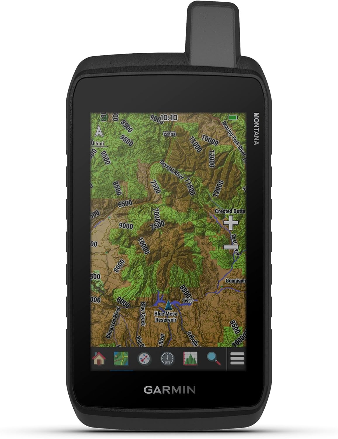
Figure 1: Front view of the Garmin Montana 710 displaying a detailed topographic map.

Figure 2: The Montana 710 showing its compass and navigation data screen, including sunrise time and estimated time of arrival.
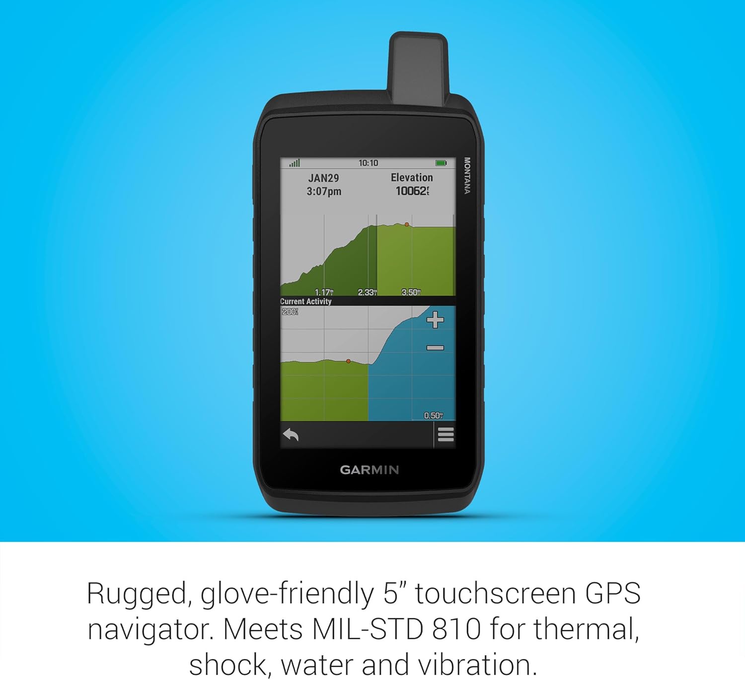
Figure 3: The device displaying an elevation profile, indicating current activity and elevation changes over distance.

Figure 4: The Montana 710 showcasing preloaded TopoActive maps with terrain contours, elevations, and landmarks.

Figure 5: High-resolution satellite imagery displayed on the Montana 710, providing a photorealistic overhead view.
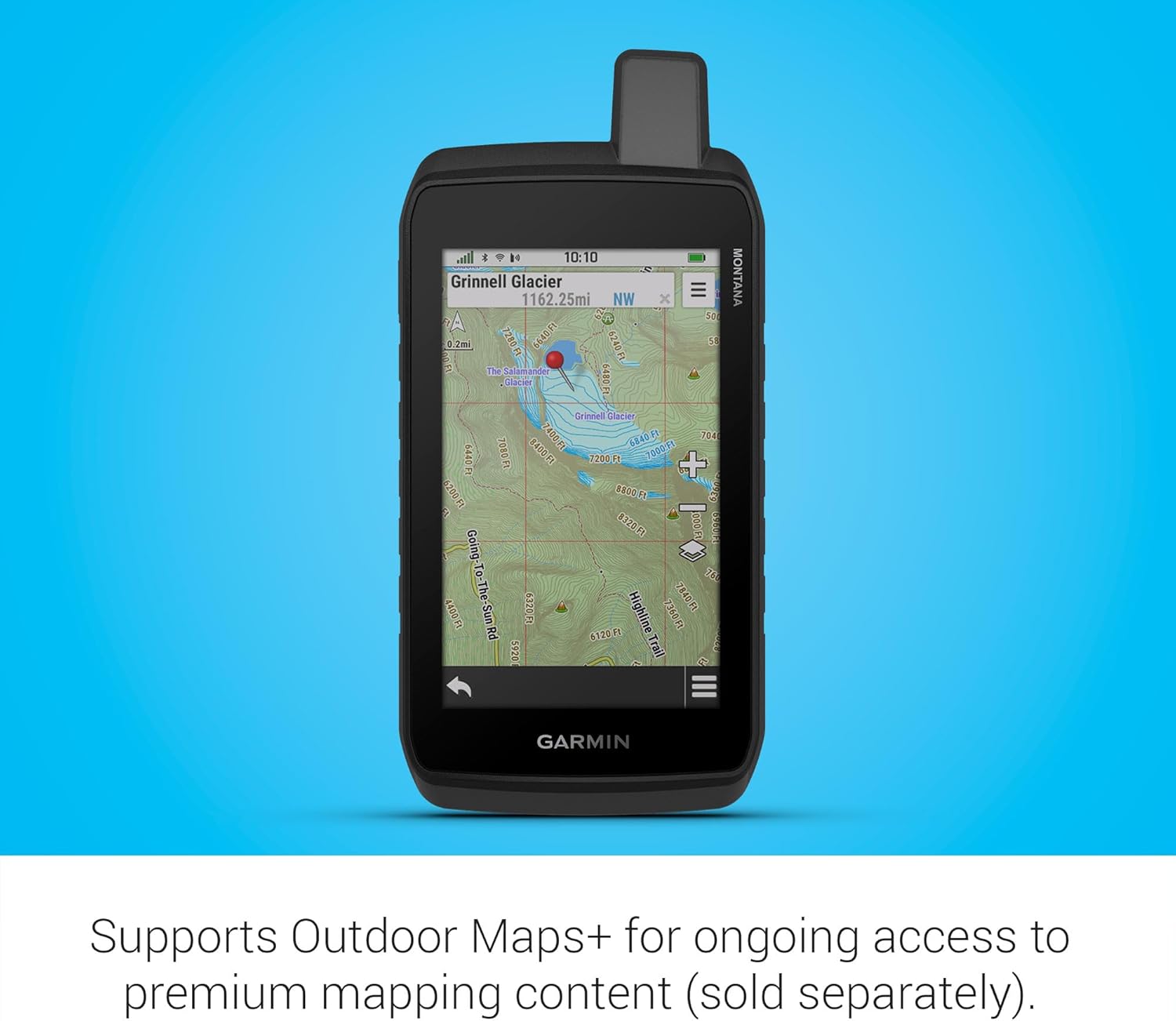
Figure 6: The device supports Outdoor Maps+ for access to premium mapping content, shown here with a detailed glacier map.
4. Setup
4.1 Initial Device Setup
- Charge the Device: Before first use, fully charge your Montana 710 using the provided USB-C cable.
- Power On: Press and hold the power button (located on the side) until the Garmin logo appears.
- Language and Region: Follow the on-screen prompts to select your preferred language, region, and other initial settings.
- Acquire Satellite Signal: For accurate positioning, ensure the device has a clear view of the sky to acquire a satellite signal. This may take a few minutes during initial setup.
4.2 Charging the Device
To charge your Montana 710, connect the provided USB-C cable to the device's charging port and plug the other end into a compatible USB power adapter (not included) or a computer USB port. The device will display the current battery charge level. Ensure the weather cap is securely closed when not charging to maintain water resistance.
4.3 Pairing with Smartphone (Garmin Explore App)
The Garmin Explore app allows you to plan trips, review data, and manage waypoints, courses, and activities. To pair your device:
- Download the Garmin Explore app from your smartphone's app store.
- On your Montana 710, go to the main menu, select Setup > Pair Phone.
- Follow the on-screen instructions in the app to complete the pairing process.
5. Operating Your Montana 710
5.1 Screen and Backlight Settings
The Montana 710 features a customizable backlight and screen timeout to optimize battery life and visibility. You can adjust these settings based on your environment and usage.
- Adjusting Brightness: Tap the power button once to access the status screen. Use the brightness slider to adjust the screen's intensity. Lower brightness saves battery.
- Backlight Timeout: Navigate to Setup > Display > Backlight Timeout. Select a duration (e.g., 15 seconds, 30 seconds, 1 minute, 2 minutes) after which the backlight will dim. For continuous display, select 'Stays On'.
- Auto Lock Screen: To prevent accidental touches and save battery, enable the 'Auto Lock Screen' feature. Go to Setup > Display > Auto Lock Screen and toggle it 'On'. The screen will lock when the backlight times out. Press the power key to unlock.
- Screen Off Shortcut: By default, a double-tap of the power button will turn the screen off while the device continues to operate in the background, saving significant battery. To re-enable the screen, single-tap the power button. This setting can be configured under Setup > System > Power Key.
Video 1: An overview of the Garmin Montana Series, highlighting key features and usage scenarios.
5.2 Navigation Basics
The Montana 710 offers various navigation tools:
- Waypoints: Mark and save specific locations. Navigate to Mark Waypoint from the main menu.
- Routes: Create and follow predefined paths. Use the Route Planner to create custom routes or load pre-existing ones.
- Tracks: Record your path as you travel. Access Recorded Activities to view and manage your tracks.
- Compass: The 3-axis electronic compass provides accurate heading information even when stationary.
5.3 Using Maps and Satellite Imagery
The device comes with preloaded TopoActive maps and supports additional mapping options:
- TopoActive Maps: Navigate using detailed topographic maps showing terrain, elevations, and points of interest.
- Satellite Imagery: Download high-resolution satellite imagery via Wi-Fi for photorealistic overhead views. This feature is subscription-free.
- Outdoor Maps+: With a separate subscription, gain ongoing access to a wide variety of premium mapping content.
5.4 Recording Activities
To record your outdoor activities:
- From the main menu, select Recorded Activities.
- Choose Start to begin recording your track.
- The device will log your path, distance, elevation changes, and other relevant data.
- To stop recording, select Stop from the activity screen. You can then save or discard the activity.
6. Maintenance
- Cleaning: Clean the device with a cloth dampened with a mild detergent solution. Wipe dry. Avoid harsh chemicals or abrasive materials.
- Battery Care: The device uses a rechargeable lithium-ion battery. For optimal battery life, avoid extreme temperatures. Store the device in a cool, dry place when not in use.
- Software Updates: Regularly check for software updates via Garmin Express on your computer or through Wi-Fi on the device. Updates provide new features and improve performance.
7. Troubleshooting
- Device Not Powering On: Ensure the battery is charged. Connect the device to a power source and attempt to power it on.
- No Satellite Signal: Ensure the device has a clear view of the sky. Move to an open area away from tall buildings or dense tree cover.
- Touchscreen Unresponsive: Perform a soft reset by holding down the power button until the device restarts. If the issue persists, ensure the screen is not locked.
- Maps Not Displaying Correctly: Verify that the maps are enabled in the device settings. Check for available map updates via Garmin Express.
8. Specifications
| Product Dimensions | 7.2 x 1.3 x 3.4 inches |
| Item Weight | 14.5 ounces |
| Item Model Number | 010-02963-00 |
| Batteries | 1 P76 batteries required (included) |
| OS | Windows (for connectivity) |
| Connectivity Technologies | Bluetooth, USB, Wi-Fi |
| Human Interface Input | Touchscreen |
| Color | Black |
| Manufacturer | Garmin |
| Model Name | MONTANA® 710 |
| Screen Size | 5 Inches |
| Map Type | North America, Topographical |
| Battery Life | 24 Hours (GPS mode) |
| Mounting Type | Panel Mount |
9. Warranty and Support
The Garmin Montana 710 comes with a standard manufacturer's warranty. For specific warranty details, please refer to the documentation included in your product box or visit the official Garmin website.
For technical support, software updates, and additional resources, please visit the Garmin support website or contact their customer service. Regular software updates are recommended to ensure optimal performance and access to the latest features.