
Garmin 010-02684-01
Contents
Garmin ECHOMAP UHD2 73sv User Manual
Brand: Garmin | Model: 010-02684-01
Introduction
The Garmin ECHOMAP UHD2 73sv is a 7-inch touchscreen chartplotter designed for marine navigation and fishfinding. It features traditional, ClearVü, and SideVü scanning sonars, preloaded Garmin Navionics+ U.S. Inland cartography, and Wi-Fi connectivity for sharing data and connecting with the ActiveCaptain app. This manual provides essential information for setting up, operating, and maintaining your device.
Setup
What's in the Box
- ECHOMAP UHD2 7” chartplotter
- GT54 transducer (where noted)
- Power/data cable
- Tilt mount
- Flush mount
- Protective sun cover
- Hardware
- Documentation
Installation Overview
Proper installation is crucial for optimal performance. Refer to the detailed instructions provided in the included documentation for specific mounting and wiring procedures. Generally, installation involves:
- Mounting the Chartplotter: Choose a secure location on your dashboard or a flat surface using either the tilt mount or flush mount kit. Ensure clear visibility and accessibility.
- Transducer Installation: Mount the GT54 transducer according to the instructions for your specific boat type (e.g., transom mount, thru-hull). Proper transducer placement is vital for accurate sonar readings.
- Wiring: Connect the power/data cable to a 12V DC power source on your boat, ensuring proper fuse protection. Connect the transducer cable to the chartplotter.

Image: The Garmin ECHOMAP UHD2 73sv chartplotter unit shown with its accompanying GT54 transducer, ready for installation.
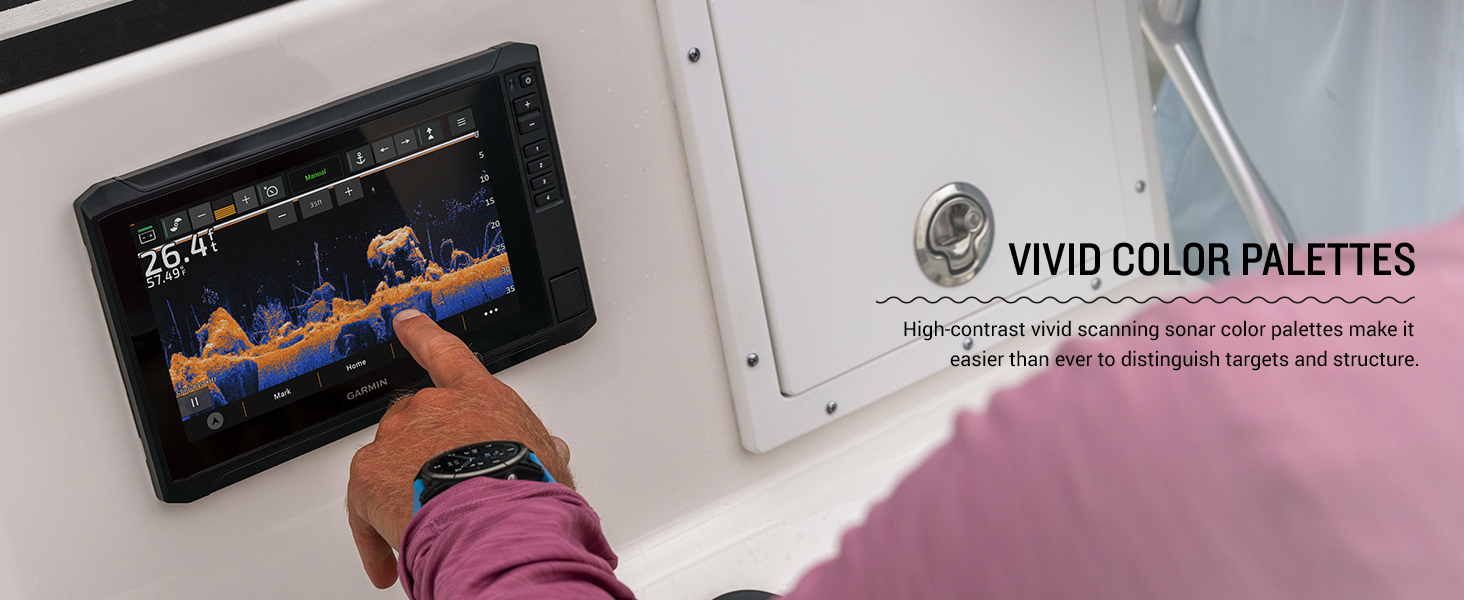
Image: A lineup of three Garmin ECHOMAP UHD2 chartplotters, showcasing various display modes including mapping, traditional sonar, and scanning sonar views.
Operating Instructions
Powering On and Initial Setup
Press and hold the power button to turn on the device. Follow the on-screen prompts for initial setup, including language selection, time zone, and unit preferences. The touchscreen interface allows for intuitive navigation through menus and features.
Sonar Functionality
The ECHOMAP UHD2 73sv supports Garmin traditional sonar, ClearVü, and SideVü scanning sonars. These technologies provide clear and detailed views of fish and underwater structures. Navigate to the Sonar page to view real-time sonar data. Adjust gain, range, and frequency settings for optimal performance in different water conditions.
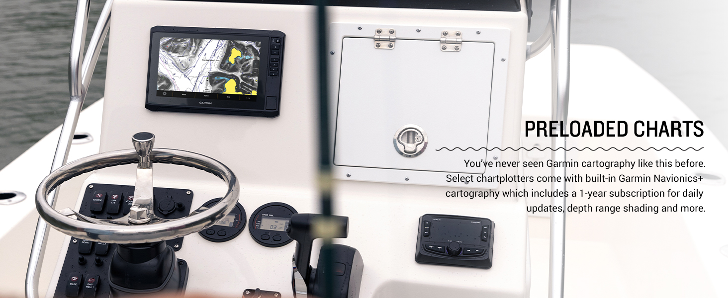
Image: A Garmin ECHOMAP UHD2 chartplotter screen showing detailed sonar returns, indicating underwater features and potential fish targets.

Image: A hand touching the screen of a Garmin ECHOMAP UHD2, which displays sonar data with vivid color palettes for enhanced target distinction.
Navigation and Charting
The device comes with preloaded Garmin Navionics+ U.S. Inland cartography, offering detailed maps of over 18,000 lakes with up to 1-foot contours. Use the chartplotter to view your current position, plan routes, mark waypoints, and navigate to destinations. The multi-band GPS provides improved position accuracy.
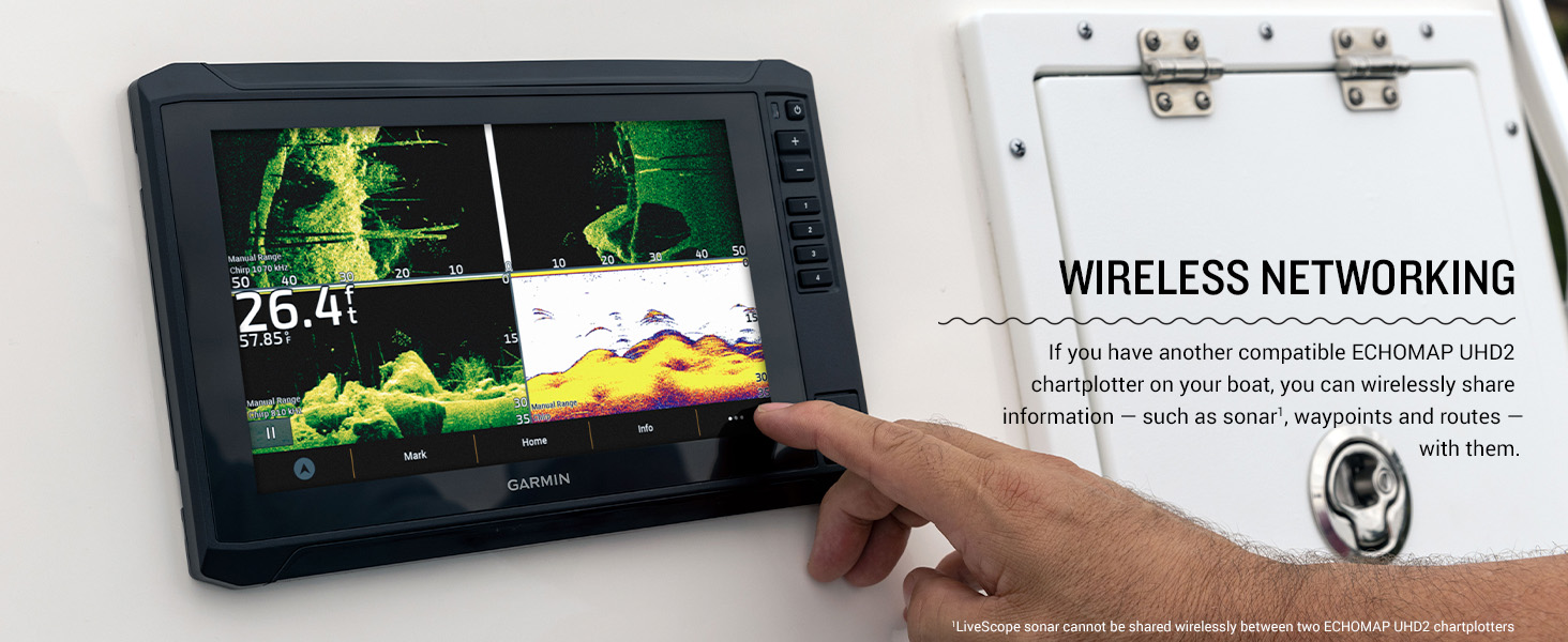
Image: A Garmin ECHOMAP UHD2 chartplotter mounted on a boat's console, showing detailed marine charts with depth contours and navigation aids.
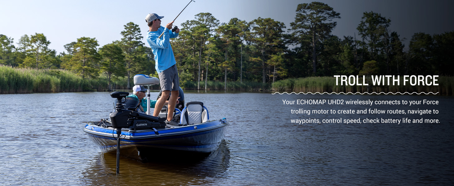
Image: The Garmin ECHOMAP UHD2 display illustrating the Auto Guidance+ technology, which suggests optimal routes for navigation.
Connectivity Features
- Wi-Fi Connectivity: The built-in Wi-Fi allows you to wirelessly share sonar, waypoints, and routes with another compatible ECHOMAP UHD2 chartplotter on your boat.
- ActiveCaptain App: Pair your device with the free ActiveCaptain app on your compatible smartphone. This app provides access to the OneChart feature, software updates, smart notifications, and the Garmin Quickdraw Community data.
- NMEA 2000® Network: The chartplotter supports NMEA 2000 networks, enabling connection to compatible autopilots, digital switching systems, and other marine electronics for integrated control and viewing.
- Force Trolling Motor Integration: Wirelessly connect to your Force trolling motor to create and follow routes, navigate to waypoints, control speed, and check battery life directly from your ECHOMAP UHD2.
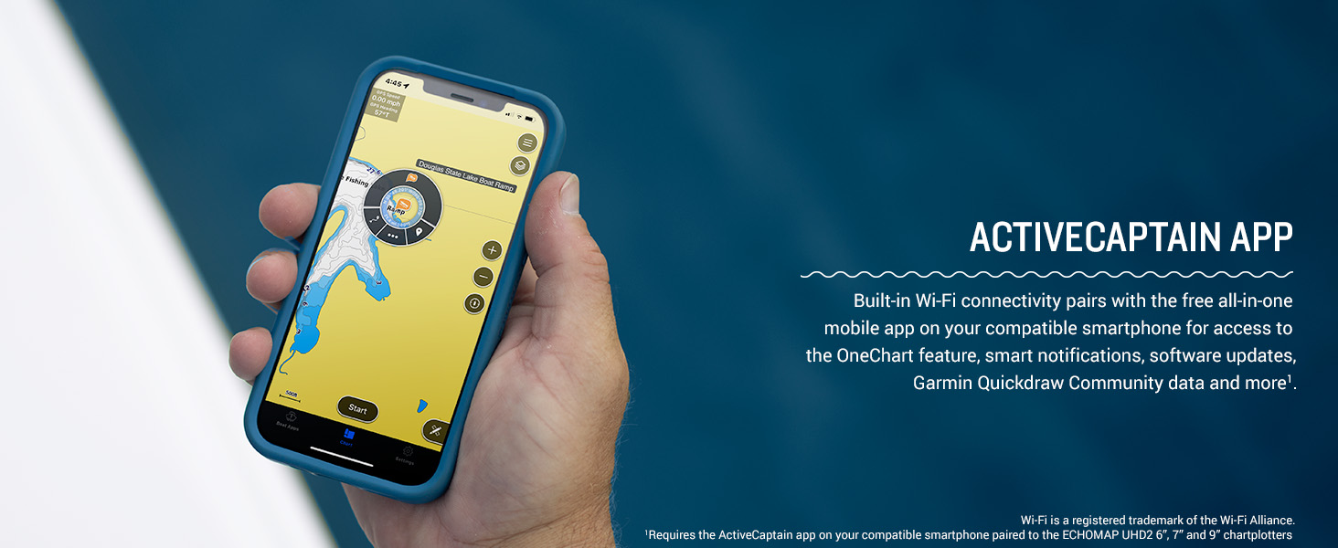
Image: A smartphone screen showing the Garmin ActiveCaptain app interface, displaying marine charts and navigation features.
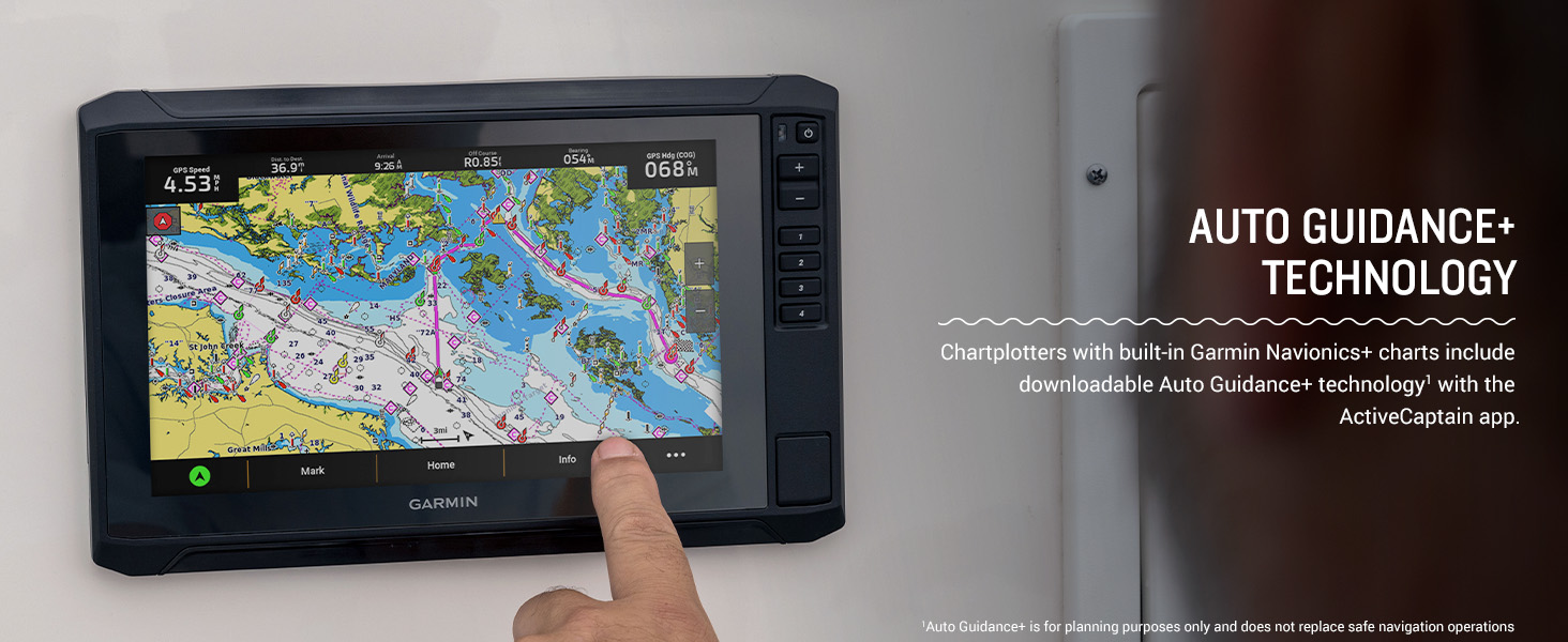
Image: A boat equipped with a Force trolling motor, demonstrating its use while a person is fishing, highlighting the integration capabilities.
Maintenance
Cleaning the Device
Regularly clean the screen and casing with a soft, clean, lint-free cloth. For stubborn dirt, use a mild soap solution and wipe gently. Avoid abrasive cleaners or solvents that could damage the display or finish.
Software Updates
Keep your ECHOMAP UHD2 software up to date to ensure optimal performance and access to the latest features. Software updates can be performed wirelessly via the ActiveCaptain app on your smartphone or by downloading updates from the Garmin website and transferring them via a microSD card.
Troubleshooting
Common Issues and Solutions
- Device does not power on: Check power cable connections, fuse, and battery voltage. Ensure the power button is pressed and held sufficiently.
- No sonar readings: Verify transducer connection to the chartplotter. Ensure the transducer is properly submerged and free of obstructions. Check sonar settings (gain, range).
- GPS signal loss: Ensure the device has a clear view of the sky. Move away from large metal objects or structures that might interfere with the signal.
- Display issues (e.g., frozen screen): Try restarting the device. If the issue persists, perform a factory reset (refer to the full manual for instructions, as this will erase user data).
For more detailed troubleshooting steps, consult the comprehensive user manual available on the Garmin support website or through the ActiveCaptain app.
Specifications
| Feature | Detail |
|---|---|
| Brand | Garmin |
| Model Name | Garmin ECHOMAP 7" |
| Model Number | 010-02684-01 |
| Screen Size | 7 Inches |
| Display Type | WVGA, TN |
| Product Dimensions | 8.6"L x 5.6"W x 3.2"H |
| Item Weight | 6.25 pounds |
| Maximum Measuring Depth | 1000 Feet |
| Connectivity Technologies | Wi-Fi |
| Special Features | Touchscreen |
| UPC | 753759307899 |
Warranty
Garmin products are backed by a limited warranty. For specific warranty terms and conditions applicable to your ECHOMAP UHD2 73sv, please refer to the warranty information included with your product documentation or visit the official Garmin website.
Support
For further assistance, technical support, or to download the latest software updates and detailed manuals, please visit the official Garmin support website. You can also find helpful resources and community forums through the ActiveCaptain app.
Garmin Support Website: www.garmin.com/support
Documents and downloads
Ask a question about this manual
Ask about setup, troubleshooting, compatibility, parts, safety, or missing instructions. Manuals+ will review the question and use this page’s manual context to help answer it.