
1. Introduction
This manual provides instructions for the installation, operation, and maintenance of your Garmin ECHOMAP UHD2 94sv chartplotter with GT56 transducer. The ECHOMAP UHD2 94sv is a 9-inch touchscreen chartplotter designed to enhance your marine navigation and fishing experience.
Key Features:
- Easy-to-use 9-inch sunlight-readable touchscreen display with keyed assist.
- Includes GT56-TM transducer for Garmin traditional, ClearVü, and SideVü scanning sonars.
- Built-in Garmin Navionics+ U.S. Coastal charts with integrated Navionics data.
- Built-in Wi-Fi connectivity for wireless sharing of sonar, waypoints, and routes with other ECHOMAP UHD2 chartplotters.
- Wireless connection to Force trolling motors for route creation, waypoint navigation, speed control, and battery life monitoring.
- Supports LiveScope sonar systems (sold separately).
- Multi-band GPS for improved position accuracy.
- Compatible with the free ActiveCaptain app for OneChart, software updates, and more.
- NMEA 2000 network support for connecting compatible autopilots, digital switching, and music.

Figure 1: Front view of the Garmin ECHOMAP UHD2 94sv chartplotter. This image shows the 9-inch touchscreen display with side buttons and the Garmin logo.
2. What's in the Box
Verify that all items listed below are included in your product packaging:
- ECHOMAP UHD2 9-inch chartplotter
- GT56 transducer
- Power/data cable
- Tilt mount
- Flush mount
- Hardware
- Documentation (including this manual)
3. Setup and Installation
Proper installation is crucial for optimal performance. Refer to the detailed installation instructions provided in the included documentation for specific mounting and wiring diagrams.
3.1 Mounting Options
The ECHOMAP UHD2 94sv can be installed using either the supplied tilt mount for dashboard installation or the flush mount for a more integrated panel appearance. Ensure the mounting location provides clear visibility and access to controls, while also protecting the device from excessive heat and direct sunlight.
3.2 Connecting the Transducer
Connect the GT56 transducer cable to the corresponding port on the back of the chartplotter. Ensure the connection is secure and waterproof. The transducer should be mounted in a location that provides an unobstructed view of the water for accurate sonar readings.
3.3 Power and Data Connections
Connect the power/data cable to the chartplotter and to your boat's 12V DC power source. Ensure proper polarity and fuse protection. The data wires can be connected to compatible NMEA 2000 networks for integration with other marine electronics such as autopilots, digital switching, and music systems.

Figure 2: Rear view of the ECHOMAP UHD2 94sv showing the various connection ports for power, transducer, and network cables.
3.4 Initial Power On and Configuration
After all connections are made, power on the device. Follow the on-screen prompts for initial setup, including language selection, unit preferences, and chart region confirmation. It is recommended to perform a software update via the ActiveCaptain app after initial setup to ensure you have the latest features and improvements.
4. Operating the Device
The ECHOMAP UHD2 94sv features an intuitive touchscreen interface with keyed assist buttons for quick access to common functions.
4.1 Sonar Functions
Your device supports multiple sonar views through the GT56 transducer:
- Traditional Sonar: Provides classic fish arches and bottom contours.
- ClearVü Scanning Sonar: Offers a clear, photographic view of fish and structure below your boat.
- SideVü Scanning Sonar: Provides a detailed view of fish and structure to the sides of your boat.
Navigate through the sonar screens using the touchscreen or side buttons. Adjust gain, range, and frequency settings for optimal performance in different water conditions. The device also supports Garmin LiveScope sonar systems for real-time scanning (sold separately).

Figure 3: The ECHOMAP UHD2 94sv displaying a ClearVü sonar view, showing detailed underwater structure.

Figure 4: The ECHOMAP UHD2 94sv displaying a SideVü sonar view, providing a wide perspective of the underwater environment.
4.2 Chartplotter and Navigation
The device comes preloaded with Garmin Navionics+ U.S. Coastal charts. You can view your current position, create and navigate routes, mark waypoints, and utilize features like Auto Guidance+ technology (for planning purposes only, does not replace safe navigation operations).
- Zooming and Panning: Use pinch-to-zoom gestures or the dedicated zoom buttons.
- Creating Waypoints: Touch and hold on the map to drop a waypoint, then edit its name and symbol.
- Route Planning: Access the Routes menu to create new routes by adding waypoints.

Figure 5: The ECHOMAP UHD2 94sv displaying detailed navigation charts with depth contours and navigational aids.
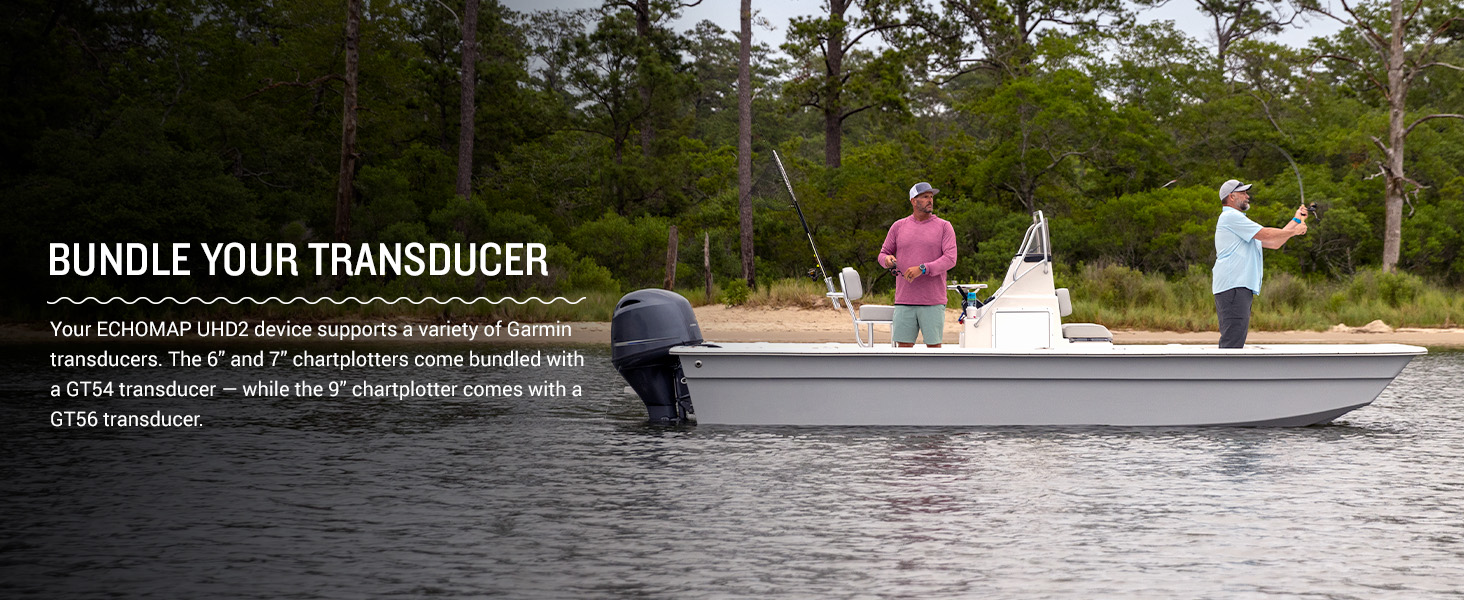
Figure 6: The chartplotter screen showing the Auto Guidance+ feature, which suggests a safe path to a destination.
4.3 Wireless Connectivity and ActiveCaptain App
The built-in Wi-Fi allows you to connect your chartplotter to the free ActiveCaptain app on your compatible smartphone. This app provides access to:
- OneChart: Access, purchase, and update charts.
- Software Updates: Download and install the latest software.
- Smart Notifications: Receive phone notifications on your chartplotter.
- Garmin Quickdraw Community: Share and download user-generated contour maps.
You can also wirelessly share sonar data, waypoints, and routes between two ECHOMAP UHD2 chartplotters on your boat.
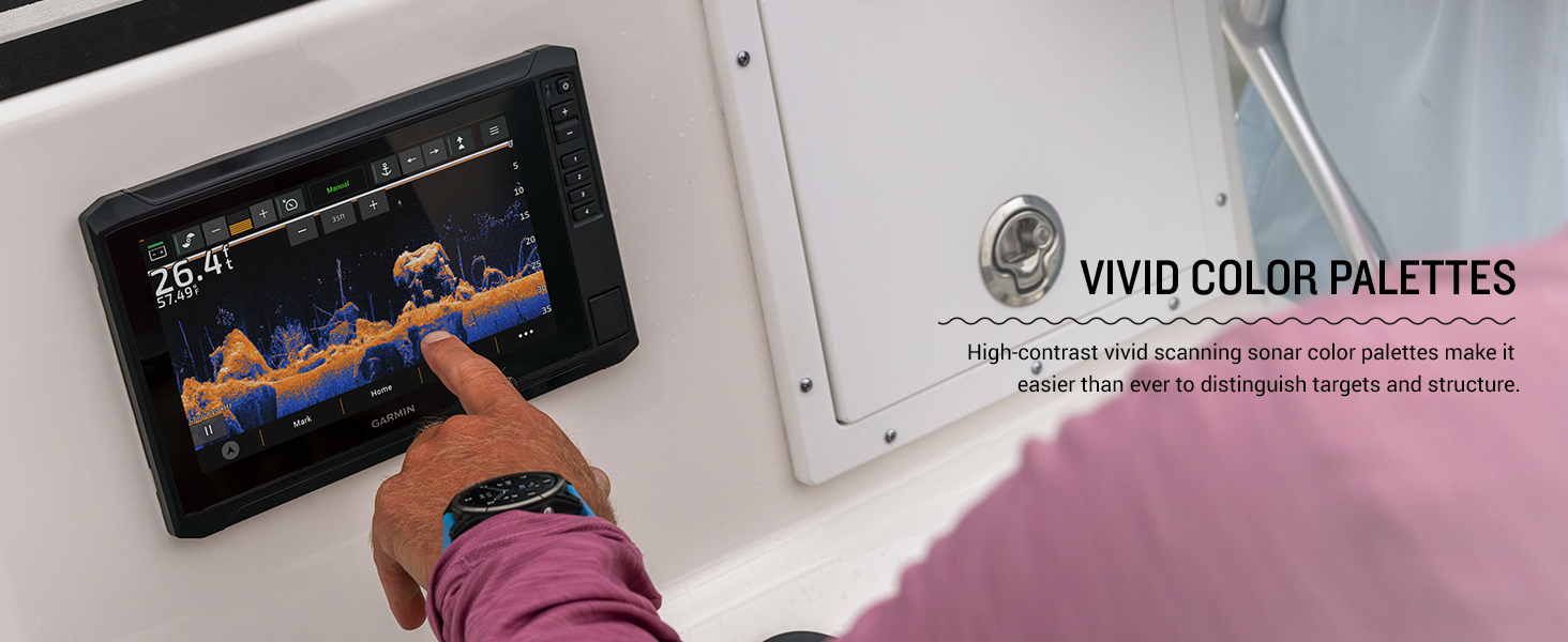
Figure 7: A smartphone screen showing the Garmin ActiveCaptain app interface, used for managing charts and device updates.
4.4 Force Trolling Motor Integration
If you have a compatible Garmin Force trolling motor, you can wirelessly connect it to your ECHOMAP UHD2 94sv. This integration allows you to:
- Create and follow routes.
- Navigate to waypoints.
- Control trolling motor speed.
- Monitor battery life.
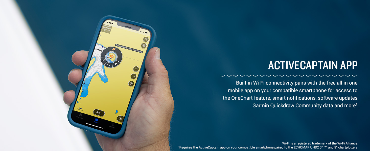
Figure 8: A boat equipped with the ECHOMAP UHD2 chartplotter and a Force trolling motor, demonstrating integrated control.
5. Maintenance
5.1 Cleaning the Device
To maintain optimal performance and screen clarity, regularly clean your ECHOMAP UHD2 94sv. Use a soft, lint-free cloth dampened with fresh water. For stubborn dirt, a mild soap solution can be used, followed by rinsing with fresh water. Avoid abrasive cleaners, solvents, or chemical-based cleaning products, as these can damage the screen and casing.
For the touchscreen, gently wipe with a clean, damp cloth. Do not use excessive force or sharp objects, which could scratch the display.
5.2 Software Updates
Garmin regularly releases software updates to improve performance, add features, and address issues. It is recommended to keep your device's software up to date. You can update the software wirelessly using the ActiveCaptain app on your smartphone or by downloading updates from the Garmin website and loading them via a microSD card.
6. Troubleshooting
This section provides solutions to common issues. For more detailed troubleshooting, refer to the official Garmin support resources or the full user manual.
6.1 Device Does Not Power On
- Check all power cable connections to ensure they are secure.
- Verify the boat's battery has sufficient charge.
- Inspect the fuse in the power cable for continuity and replace if blown.
6.2 No Sonar Readings or Poor Sonar Performance
- Ensure the transducer cable is securely connected to the chartplotter.
- Verify the transducer is properly mounted and submerged in water.
- Check for obstructions near the transducer that might interfere with the sonar signal.
- Adjust sonar gain and range settings.
- Clean the transducer face to remove any marine growth or debris.
6.3 GPS Not Acquiring Position
- Ensure the device has a clear view of the sky.
- Allow several minutes for the device to acquire satellite signals, especially after moving to a new geographical area.
6.4 Touchscreen Unresponsive
- Ensure the screen is clean and dry.
- Perform a soft reset by holding the power button until the device restarts.
7. Specifications
| Feature | Specification |
|---|---|
| Brand | Garmin |
| Model Name | Garmin ECHOMAP 9" |
| Item Model Number | 010-02689-01 |
| UPC | 753759308001 |
| Screen Size | 9 Inches |
| Display Type | Touchscreen |
| Scanner Resolution | 1024 x 600 |
| Product Dimensions | 10.4"L x 6.5"W x 3.2"H |
| Item Weight | 8.51 pounds |
| Power Source | Battery Powered (12V DC boat system) |
| Mounting Type | Dashboard Mount or Panel (Tilt/Flush) |
| Connectivity | Wi-Fi, NMEA 2000 |
| Special Features | Touchscreen, Wireless Connectivity, Sonar Support (Traditional, ClearVü, SideVü, LiveScope compatible) |
8. Warranty and Support
For warranty information, technical support, and additional resources, please visit the official Garmin website or refer to the warranty card included with your product.
You can also download the complete user manual in PDF format for detailed instructions and diagrams: